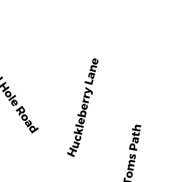
150-U-3 SHAD HOLE ROAD DP
Owner Information
JOHNSTON EDWARD TRUSTEE
238A NEVADA STREET
NEWTON, MA 02460


Property Details
150-U-3 SHAD HOLE ROAD DP is classified as a Residential Condominium (Cottage yrrnd).
The primary structure on this property was built in 1950. There are 613ft2 of built area within this property. There is 613ft2 of residential/living space within this property. This property is listed as having 5 rooms.
150-U-3 SHAD HOLE ROAD DP is valued at $145,800. The land is valued at $0 and the structures are valued at $144,800. There is an additional valuation of $1,000 on this property.
The most recent deed for 150-U-3 SHAD HOLE ROAD DP is recorded at the local registrar in Book 30367, Page 8. 150-U-3 SHAD HOLE ROAD DP was last sold on Wednesday, March 22, 2017 for $0.
Assessment data from fiscal year 2022.
Flood Data
This property is partially within the AE Zone (within floodplain). Approximately 0.58 acres (85.25%) of the property is within this zone.
The base flood elevation for this flood zone is 11 feet.
This information is sourced from the FEMA National Flood Hazard Layer. See our full disclamer.
Broadband Internet Providers
| Provider | Type | Bandwidth (mbps) | |
|---|---|---|---|
| HughesNet | Satellite | 25 | 3 |
| GCI Communication Corp. | Satellite | 0 | 0 |
| Comcast | Cable | 1000 | 35 |
| Verizon New England Inc. | DSL | 5 | 0 |
| Viasat Inc | Satellite | 35 | 3 |
| VSAT Systems, LLC. | Satellite | 2 | 1 |
Broadband service provider data from December 2020.
Adjacent Properties
- 7 HUCKLEBERRY LANE DP
Single Family Residential owned by MONAHAN MARGARET MALOY ET AL - 11 TOMS PATH DP
Single Family Residential owned by CROSS VERONICA E TRUSTEE - 19 HUCKLEBERRY LANE DP
Single Family Residential owned by PARTISANO NANCY B - 9 HUCKLEBERRY LANE DP
Single Family Residential owned by BOYER DONALD R TRUSTEE - 15 HUCKLEBERRY LANE DP
Single Family Residential owned by SHTEIN ILYA - 140 SHAD HOLE ROAD DP
Single Family Residential owned by WHITE JOYCE M TRUSTEE - 7 TOMS PATH DP
Single Family Residential owned by MAHONEY JOSEPH E ET UX